What is This Service?
Geographic Information Systems (GIS) is a powerful technology for capturing, storing, analyzing, and visually presenting all types of **spatial data**. It is not just a map, but an interactive system with a deep database behind it.
At GeoCompany, we use GIS technologies to convert complex geological, geographical, and statistical data into easily understandable visual formats. This enables you to make more **accurate and informed decisions** in your projects, minimize risks, and use resources more efficiently.
Application Areas
GIS technology is indispensable for planning and managing projects in various fields.
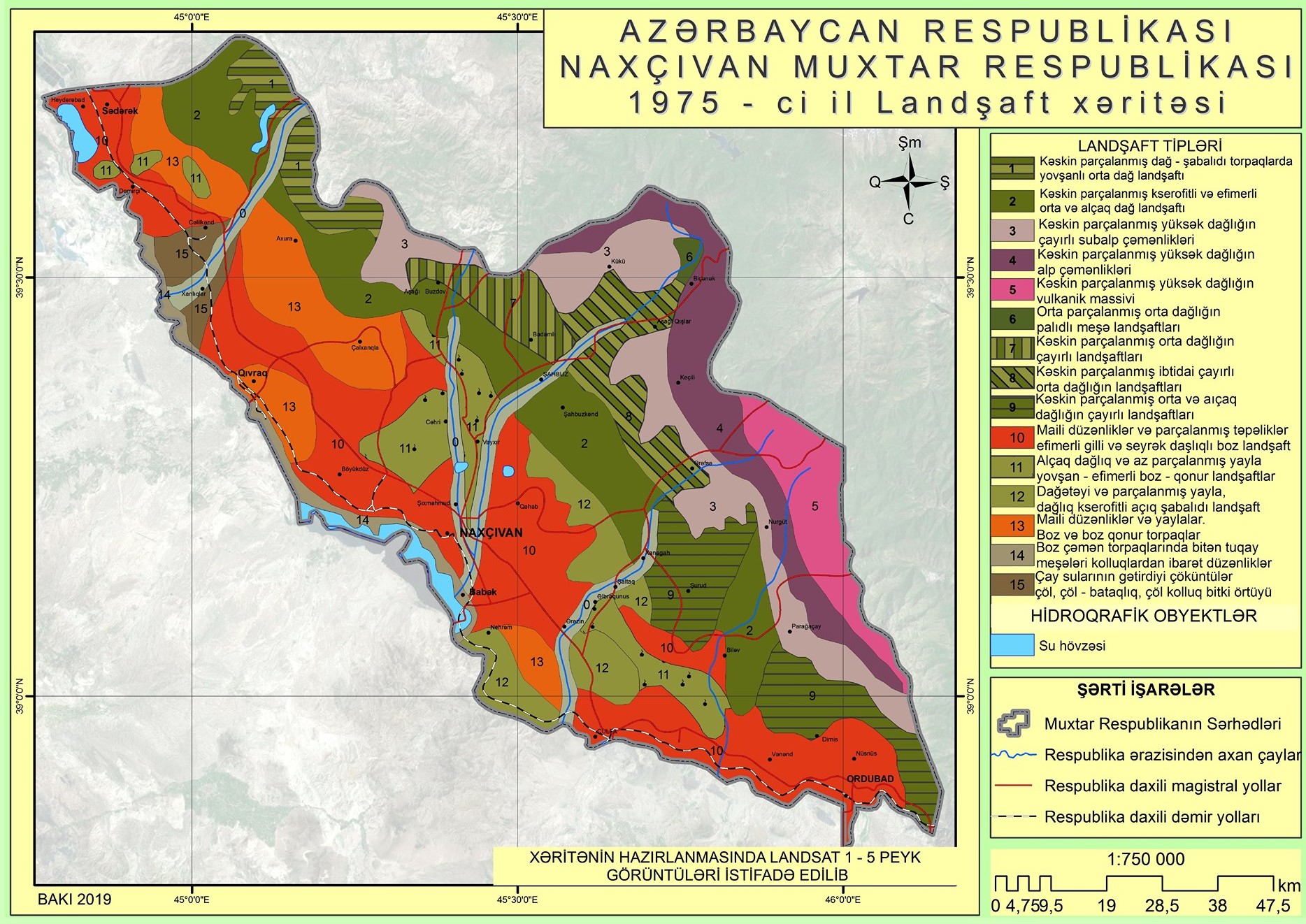
Geological Mapping
We create accurate maps of rock types, faults, and mineral deposits, facilitating exploration work.
Resource Management
Calculating reserves in mines and quarries, planning, and optimizing extraction processes.
Risk Analysis
Identifying areas at risk of landslides, floods, and other natural disasters to implement safety measures.
Environmental Monitoring
Modeling the spread of pollution, assessing environmental conditions, and planning restoration work.
Our Work Process
We approach each project individually and apply our proven work methodology for successful results.
Data Collection
We collect data from various sources such as field surveys, satellite images, and existing maps.
Database Creation
All collected spatial data is combined and digitized into a single GIS database.
Spatial Analysis
Our specialists conduct complex analyses on the data according to the project's requirements.
Mapping & Presentation
We present the analysis results in the form of easy-to-understand thematic maps and interactive reports.
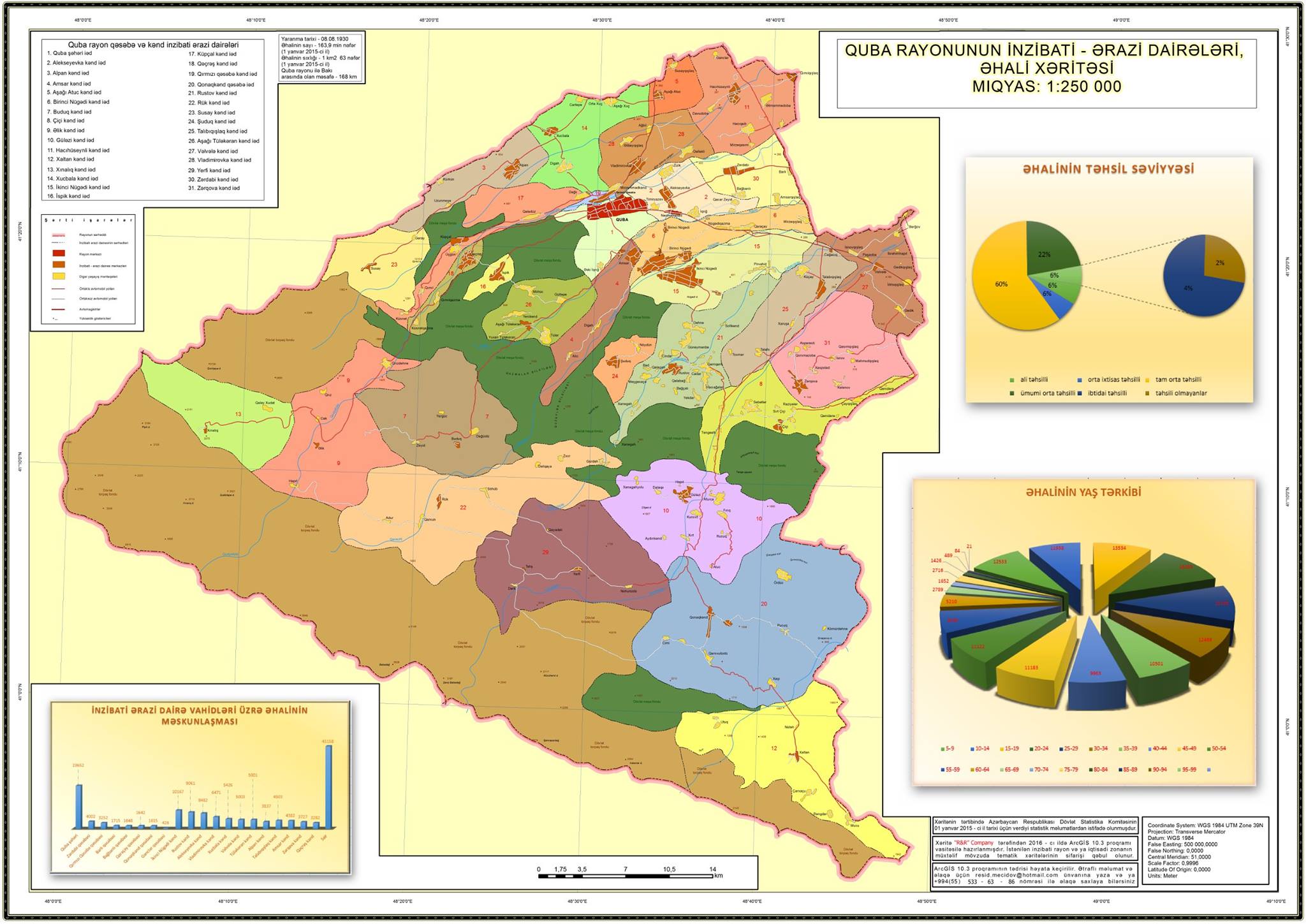
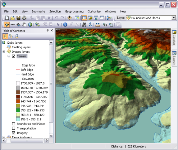
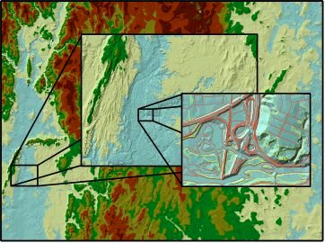
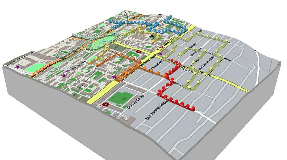
Examples of Our Work
Some examples of maps created with GIS technology.
Let's Start Your Project
Leverage our GIS services to turn your data into a strategic advantage. Contact us for a free consultation.
Contact Us Now
 AZ
AZ EN
EN RU
RU